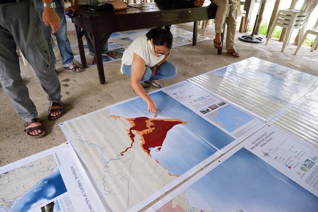
IP leaders use advocacy maps to show how Kaliwa Dam will impact them
With construction set to begin imminently in order to turn Daraitan into the reservoir for the Kaliwa Dam in Rizal, Philippines, there is great concern about the impact this will have on the area and the indigenous people (IP) living there. Daraitan is part of their vast ancestral domain in the southern range of Sierra Madre, home to Mt. Daraitan, a famous mountaineering site along the borders of Tanay and Quezon Province. To show how the areas will be affected, Pambansang Kilusan ng mga Samahang Magsasaka (PAKISAMA), Asian Farmers’ Association for Sustainable Rural Development (AFA), Land Matrix Initiative, and Philippine Association for Intercultural Development, together with the Agta-Dumagat-Remontado leaders in Rizal and Quezon, have therefore developed advocacy maps.
These show, for example, that a great part of Daraitan will be submerged, with half of the 428-hectare land area within the projected flood zone. It includes farms, trails to hiking sites, and residential and government facilities for over 5,000 residents. Communities by the river will need a longer bridge because they will be isolated. Sacred places will also be gone, like the Tinipak River, which is also a tourist attraction and a source of potable water. At least 5,000 IPs will be affected, along with their farms and hunting grounds. For Infanta, the biggest effect will be on irrigation, aquifer, and sedimentation. As a delta, hindering the refill of sediments will cause the erosion of the ground and the eventual eradication of Infanta on the Philippine map, thus affecting 84,018 residents. >>Read more